
The Unusual Highway Signage of West Virginia
The Mountain State has a unique — and confusing — highway classification system.

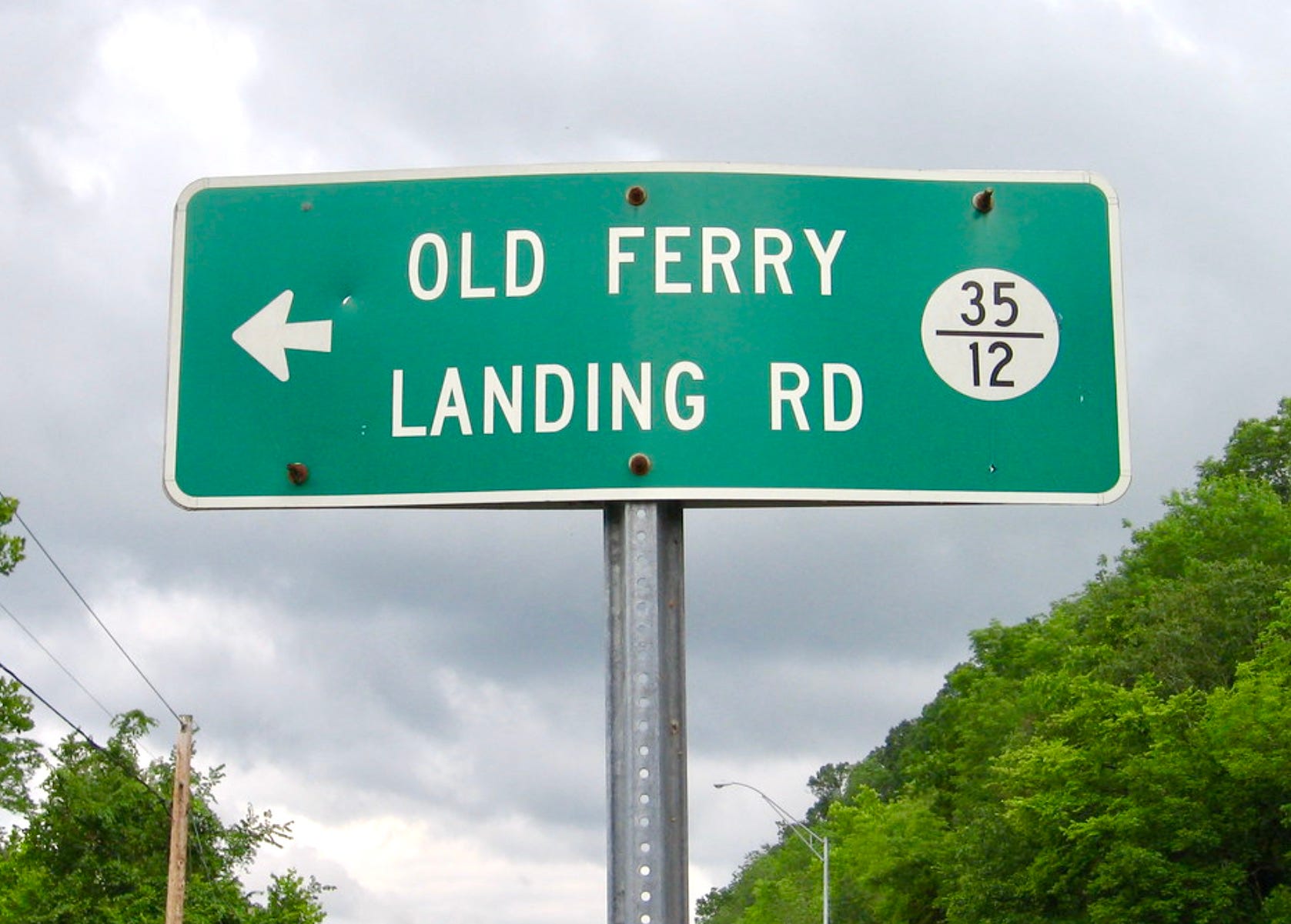
While I was working on the piece about places with fractional street names, which was published earlier this week, I became aware of the type of sign shown above, which appears to show a fraction — but that’s not what it is.
This type of sign can be found all over the state of West Virginia. Despite the fraction-esque numerical format, the two numbers are not a traditional numerator or denominator. The Flickr user who took this photo explains what the numbers mean:
“Major” county highways [in West Virginia] usually have a whole number as the route designation, while “minor” county highways have a number in a fractional format. These numbers are assigned in a “mainline and spur” fashion: The first minor road branching off of Highway 23 would be 23/1, followed by 23/2, 23/3, and so on until resetting at the county line.
[…]
This fractional system dates back to the 1930s, and the “numerator” designations almost never change, even if the highway they reference is rerouted or decommissioned. As a case in point, this particular road in Putnam County remains designated as 35/12, even though U.S. 35 hasn't actually been routed this way since the Silver Bridge collapse in the 1960s.
Crazy, right? As far as I can tell, there’s nothing else like this in any other state. Some additional info comes from the website of highway sign enthusiast Andrew Turnbull, who says:
In 1933, a legislative act was passed placing all roads in West Virginia under state control. Next, the State Road Commission went to work inventorying and mapping these “lesser” roads. Through roads that connected one place to another were assigned whole numbers (1, 2, 3, etc.) and treated as secondary “trunks.”
Minor connecting and spur roads were treated as “tributaries” of the state highways and secondary trunks they branched off from, and were assigned fractional numbers. The roads abutting Highway 44 would bear the numbers 44/1, 44/2, 44/3, and so on, then reset at the county line. The “denominators” were numbered in the sequential order in which the state inventoried and commissioned them, not always in the order of geography.
So at one point, Old Ferry Landing Road — the road referred to in the header photo — was the 12th spur to branch off from U.S. 35, and it has kept its 35/12 designation even though U.S. 35 no longer runs through this portion of Putnam County.
Confused yet? It gets even weirder. Here’s more from Andrew Turnbull: