

Boundary Issues, Day 3: State Line Towns and Roads
It’s the third installment in our weeklong look at territorial borders.

This post is part of a weeklong series of articles about territorial borders, called Boundary Issues. You can see other articles in this series, along with the article from last week that inspired this week’s content, here. All articles this week are non-paywalled. Enjoy!
In 1998 I read an interesting article about the tiny town of State Line City, Indiana. As its name implies, the town is located right against a state border — in this case, the border separating Indiana from Illinois:

If we zoom in for a closer look, you can see that while the official municipality is in Indiana, a little portion of the greater State Line City community extends across the border into Illinois:

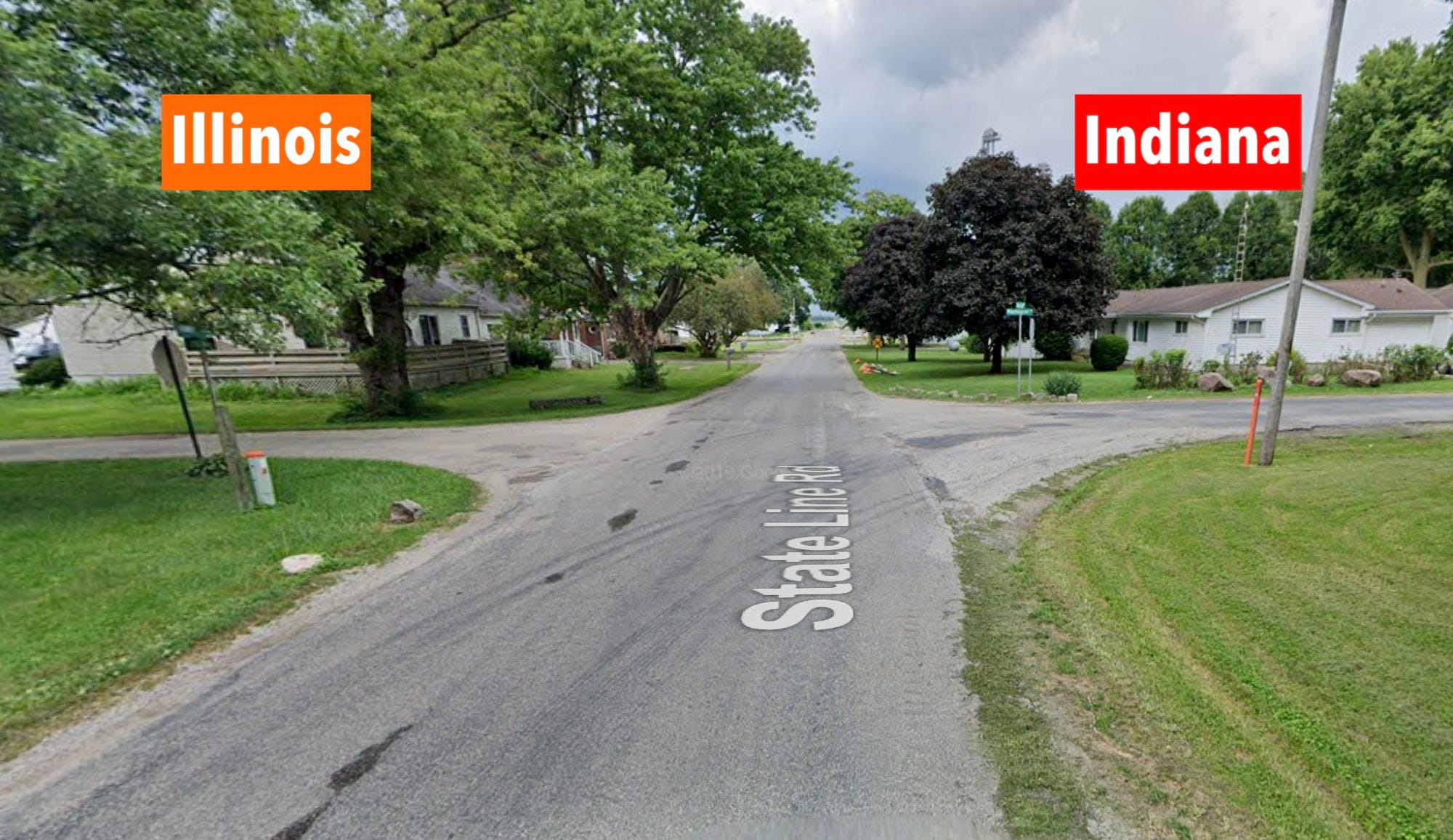
As you can also see, the border runs down the center of a thoroughfare called, appropriately, State Line Road. That means people who live on one side of the street are residents of Indiana, while those on the other side are in Illinois. According to that 1998 article, the Illinoisans on the west side of State Line Road are technically residents of the nearest Illinois town with a post office — Bismarck, which is about 10 miles away — but they’re very much part of the State Line City community, and most of them have P.O. boxes in State Line City, because that’s easier than going to Bismarck.
What really intrigued me about the article was this tidbit: Because the two sides of State Line Road are in different states, telephoning across the street was an expensive long-distance call (remember, this was in 1998, before everyone had a cell plan). As a result, according to one local resident quoted in the article, neighbors living on opposite sides of State Line Road were more inclined to “just walk over and sit on the porch and talk, you know, face to face; it’s kind of nice.”
A few months after I read that article, I was visiting a friend in Chicago and insisted that we make the two-and-half-hour drive down to State Line City. I didn’t observe a particularly vibrant porch-socializing scene, but I did notice something interesting: When a street intersected State Line Road, the street signs on opposite sides of the road were rendered in two different fonts, and on two differently shaped sign blanks, presumably because they were produced by two different state transportation departments.
But that was 27 years ago. Is it still the case today? Fortunately, I don’t have to go all the way back to State Line City to answer that question; I can simply consult Google Street View, which confirms that the sign styles are indeed still distinct:

This situation isn’t unique. There are at least 10 other American towns named either State Line or Stateline, and there are also lots of other State Line Roads out there (including a 12.5-mile stretch of highway that runs along the Kansas/Missouri border for most of the Kansas City metro area).
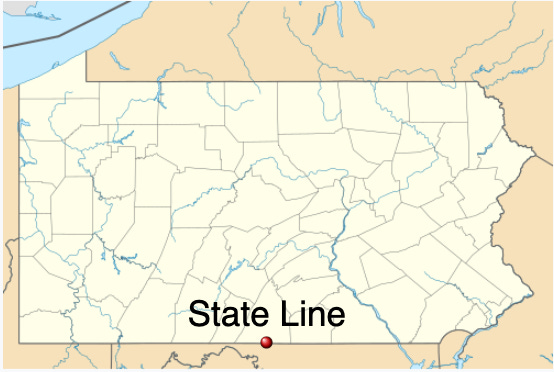
Then there’s State Line, Pennsylvania, which is just north of the Keystone State’s border with Maryland:
This town also has a State Line Road — although, interestingly, Google Street View refers to it as Mason Dixon Road, for obvious reasons:

If you’re traveling in this area, you can even stay at the State Line Motel. Disappointingly, it’s wholly on the Maryland side of the border — not as much fun as if it straddled the border and you could choose your room based on which state it was in.

Even better, there’s the town of Beebe Plain, Vermont, which is nestled against the U.S./Canada border:

If we zoom in, you can see that Beebe Plain is part of a larger community formed with its sister municipality of Stanstead, Quebec:

And that highway running along the border? It’s called Canusa Street (or, on the Canadian side, Rue Canusa). The north side of the street is in Canada, and the south side is in the U.S., with the border running down the center.

According to Wikipedia, “The yellow line running down the middle of the road in the section along the 45th parallel is treated as the international border, separating United States on the south from Canada on the north.” But as you can see in the image shown above, the road actually has a double yellow line, so wouldn’t the border actually be the blank space in between? Or, more specifically, the midpoint of the blank space? (Also: It would be soooo conceptually satisfying if the two yellow lines were painted by two separate highway crews — one American, one Canadian — but that doesn’t appear to be the case.)
As you might imagine, living on opposite sides of an international border can be a bit trickier than the Indiana/Illinois situation. To learn more about that, look here and here.
Do you know of other roads that straddle a border, with people on opposite sides of the street living in different territories? If so, let’s hear about them.
Paul Lukas has been obsessing over the inconspicuous for most of his life, and has been writing about those obsessions for more than 30 years. You can contact him here.
Bristol is a similar, if larger example being bisected by the VA TN border. The middle of the yellow line on State Street has small plaque that says Virginia on one side and Tennessee on the other
This series is coming on nearly the exact 10 year anniversary of the transfers of a huge number of exclaves/enclaves, along the India/Bangladesh border. Prior to 2015, there was a mish mash of over a hundred along the border. I miss that geographic factoid: https://en.m.wikipedia.org/wiki/India–Bangladesh_enclaves