
Boundary Issues, Day 2: Border Monuments
It’s the second installment in our weeklong look at territorial borders.

This post is part of a weeklong series of articles about territorial borders, called Boundary Issues. You can see other articles in this series, along with the article from last week that inspired this week’s content, here. All articles this week are non-paywalled. Enjoy!
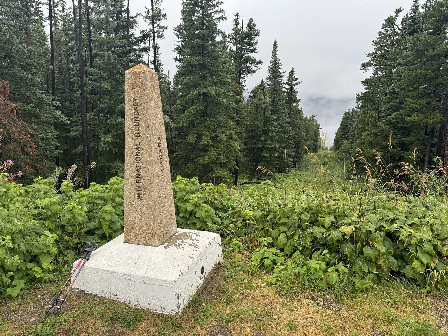
In Thursday’s article about enclaves, exclaves, and pene-exclaves, I mentioned that a long portion of the U.S./Canada border is marked by a deforested strip of land called the Slash. But that’s not the only thing marking the boundary. The Slash, and the rest of the U.S./Canada land border, is studded with 5,528 survey monuments (including the one shown above). The monuments are maintained by the International Boundary Commission, which was created in 1908 to ensure border accuracy between the two nations.

Monuments of various sorts, their locations usually determined by geological surveyors, are a common sight at borders all over the world. On a practical level, they establish the bounds of territorial sovereignty as spelled out by treaties or legislation. But they also serve a ceremonial function, reinforcing the notion that crossing a border is a Big Deal. If borders are essentially abstractions that humans impose on the landscape, monuments help make those abstractions seem more real.
Considering the charged political climate surrounding America’s border with Mexico, you might be surprised (as I was) to learn that a similar array of stately-looking monuments runs along that border. There are 276 of them, and they look very much like the U.S./Canada monuments, offering mute testimony to a simpler time, long before any talk of drug smuggling, migrant trafficking, terrorism, or building a wall.
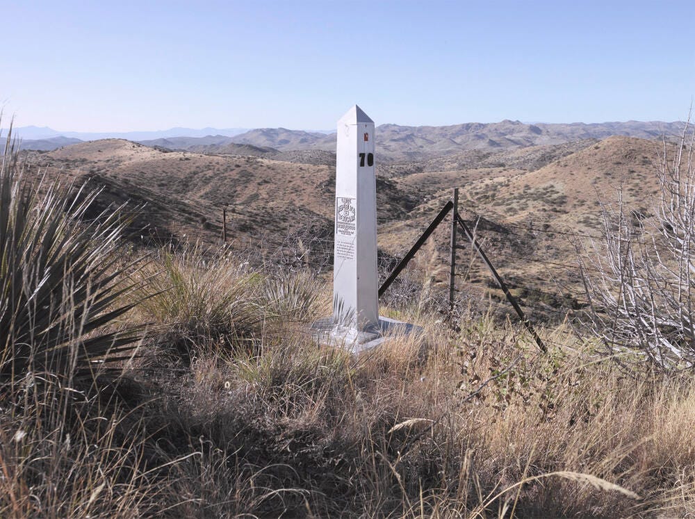
In 2007, a photographer named David Taylor embarked on a project to document all 276 of the U.S./Mexico markers. You can see the resulting photos here, and here’s a funny story about what he had to go through in order to access one of the markers.
While the U.S./Canada and U.S./Mexico monuments are handsome obelisks, some border monuments are, well, less monumental. The border between North and South Dakota, for example, is lined with hundreds of innocuous quartzite markers that were installed in 1891 and ’92. They have “S.D.” carved into the stone on one side and “N.D.” on the other (although at least one of them has an interesting typo). Most of them are on private property, but a few are close to where highways pass through, allowing motorists to pull over and take a look. (I did this myself a few times while road-tripping through the region in the late 1990s, although I can’t find the photos I took with my film camera at the time.)
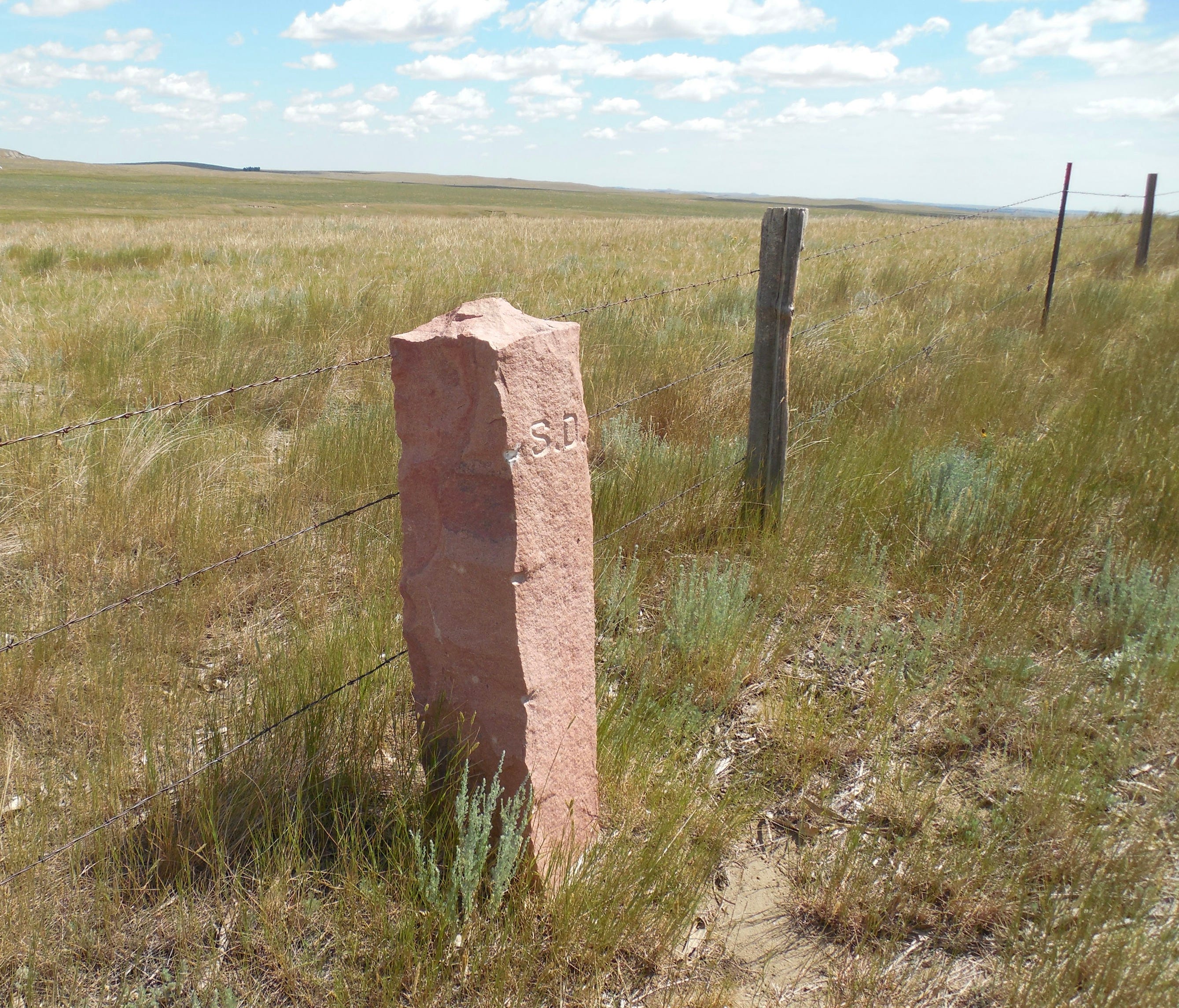
There were originally 720 of these markers, erected at half-mile increments along the 360-mile border that divided the Dakota Territory into two states. By 2012, only about half of them remained, but volunteers have mounted an effort in recent years to restore the ones that are missing or damaged. (Meanwhile, the monuments have served as the inspiration for the Dakota Marker trophy, which was created in 2004 and is awarded each year to the winner of the annual college football rivalry game between North Dakota State and South Dakota State.)
One of my favorite border monuments is located in the woods off a desolate road near the upstate New York hamlet of Hale Eddy. Here’s a look at Hale Eddy’s location, followed by a closer look at the town itself:


See Faulkener Road, which crosses from New York into Pennsylvania as it extends to the southeast? It’s a narrow, minor road that doesn’t get much traffic; in fact, I think it may have been a dirt road until relatively recently. But if you happen to be driving on it, here’s what you’ll encounter as you approach the state line:
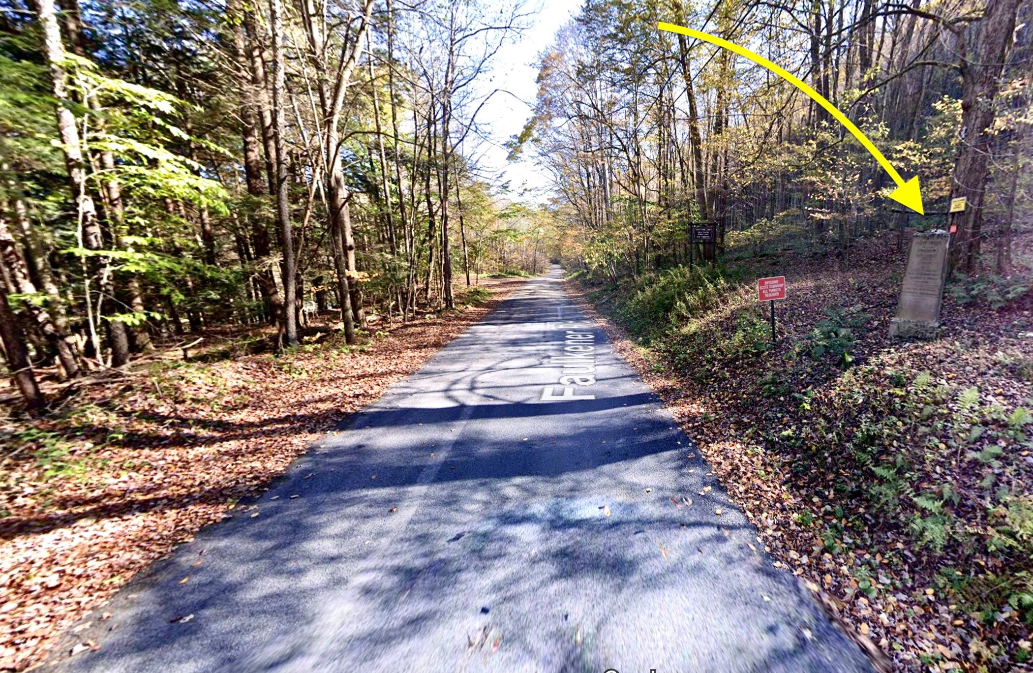
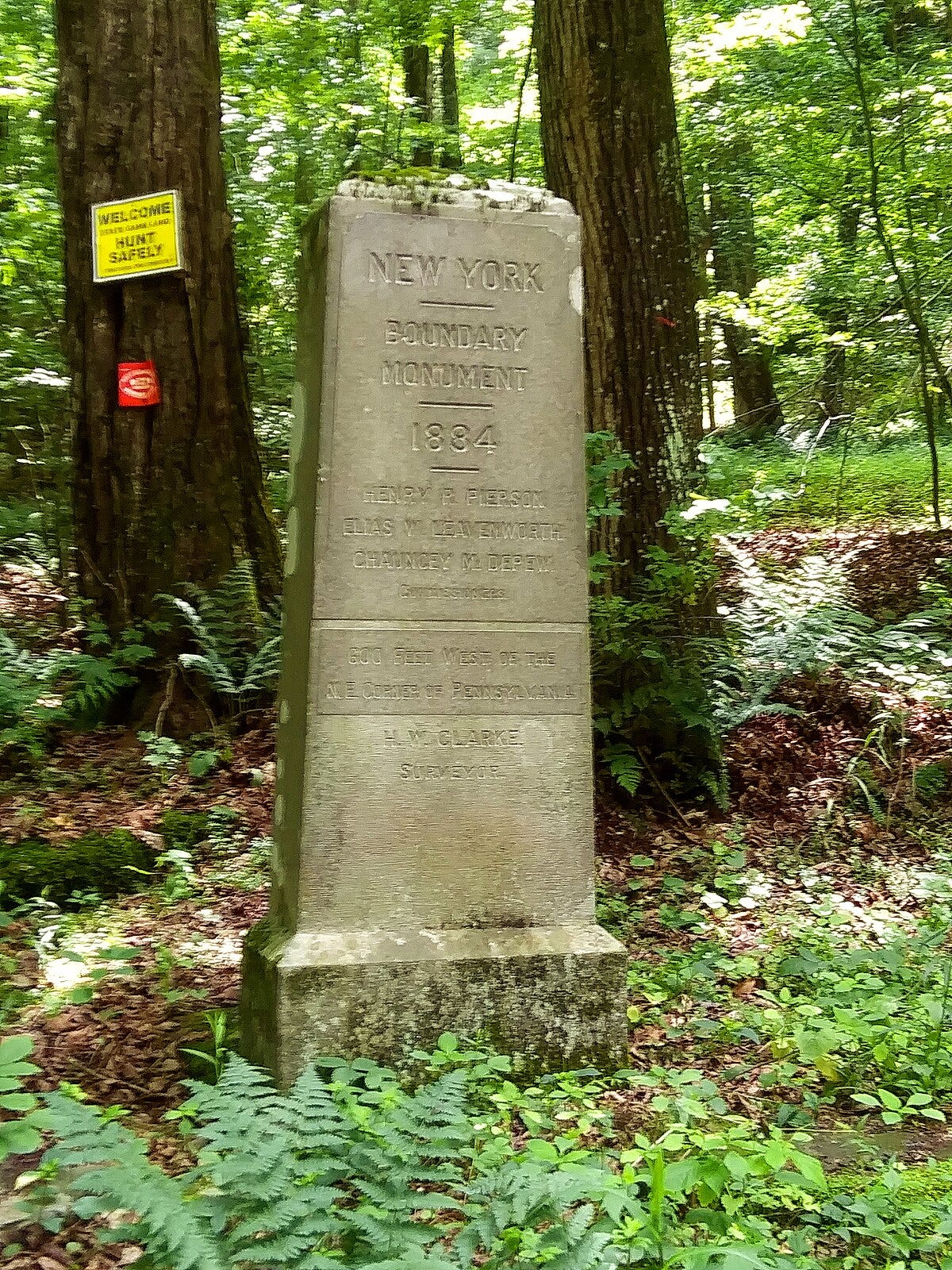
Nice, right? This monument, which was erected in 1884, was shown to me several decades ago by a college friend who grew up in Hale Eddy; otherwise I probably wouldn’t know about it. Here’s the view from the other side:

I’ve always liked how this monument looks all official and majestic but is just sitting there in the woods, off to the side of an obscure road that few people even travel on. I make a point of visiting it whenever I’m in that region.
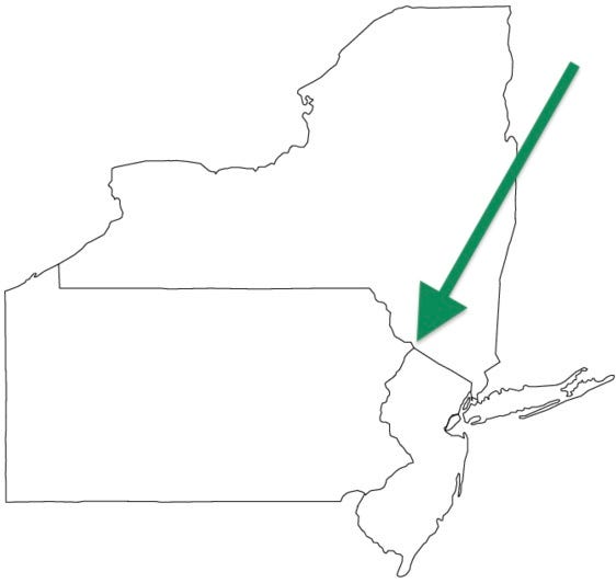
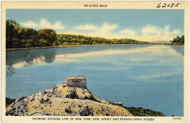
What’s even better than a monument marking the border between two territories? A monument marking the borders between three territories, of course. This type of border convergence is called a tripoint, and there are 60 of them in the United States. Of those, 36 are on dry land (the rest are in bodies of water), and many of those are marked by tripoint monuments. Here, for example, is a look at the point where New York, New Jersey, and Pennsylvania meet, followed by a photo of the monument that can be found at that spot:
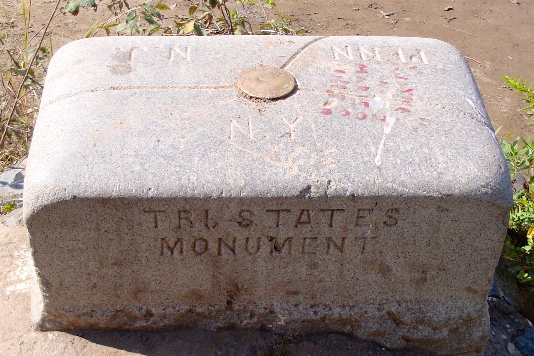
This monument is so famous, it was even featured on a postcard in the 1930s — check this out:
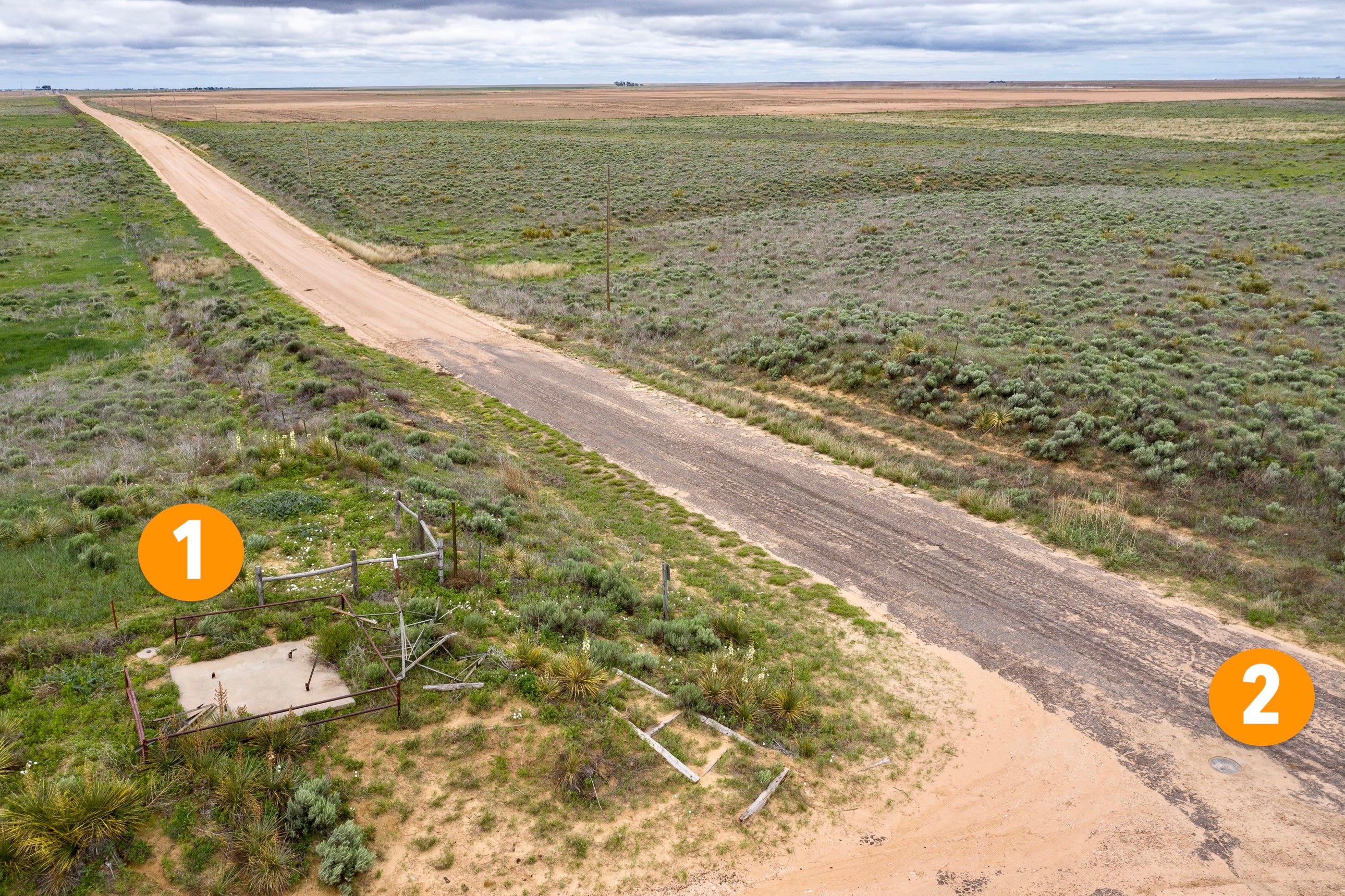
There are plenty of other tripoint monuments out there, but the most interesting one can be found at the junction of Colorado, Kansas, and Oklahoma. Again, here’s a map of that spot, followed by the unusual monument that’s been installed there:

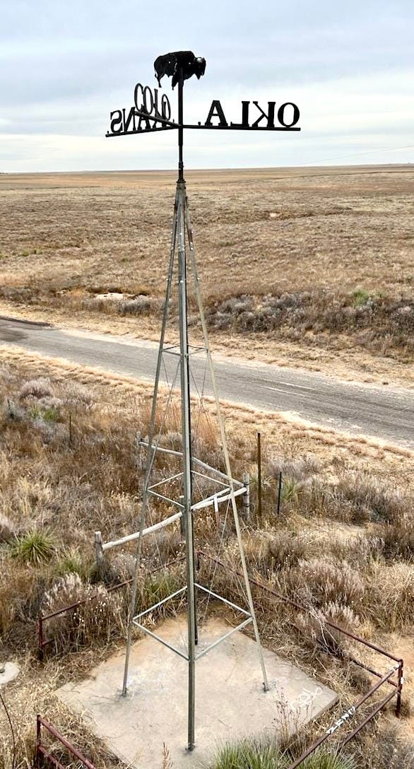

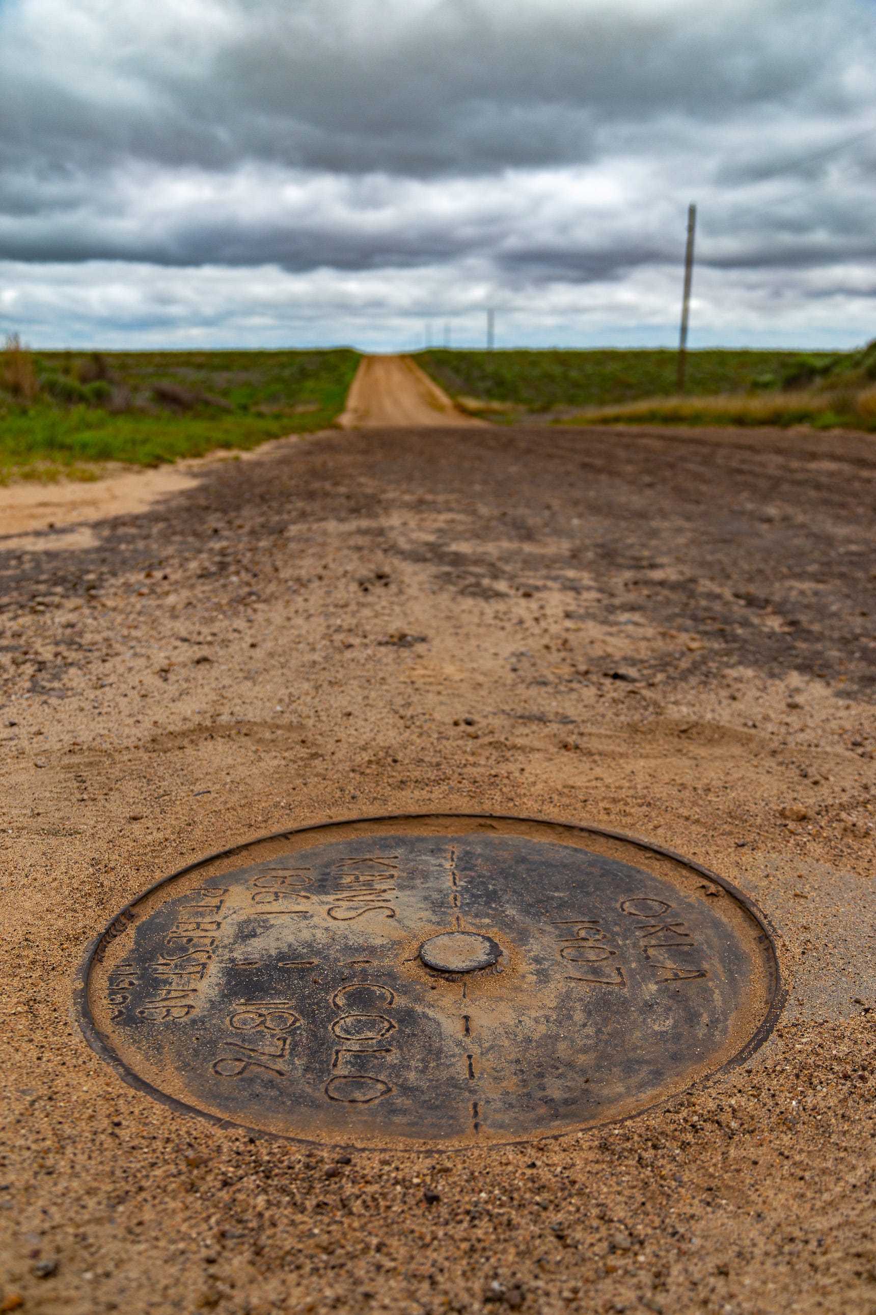
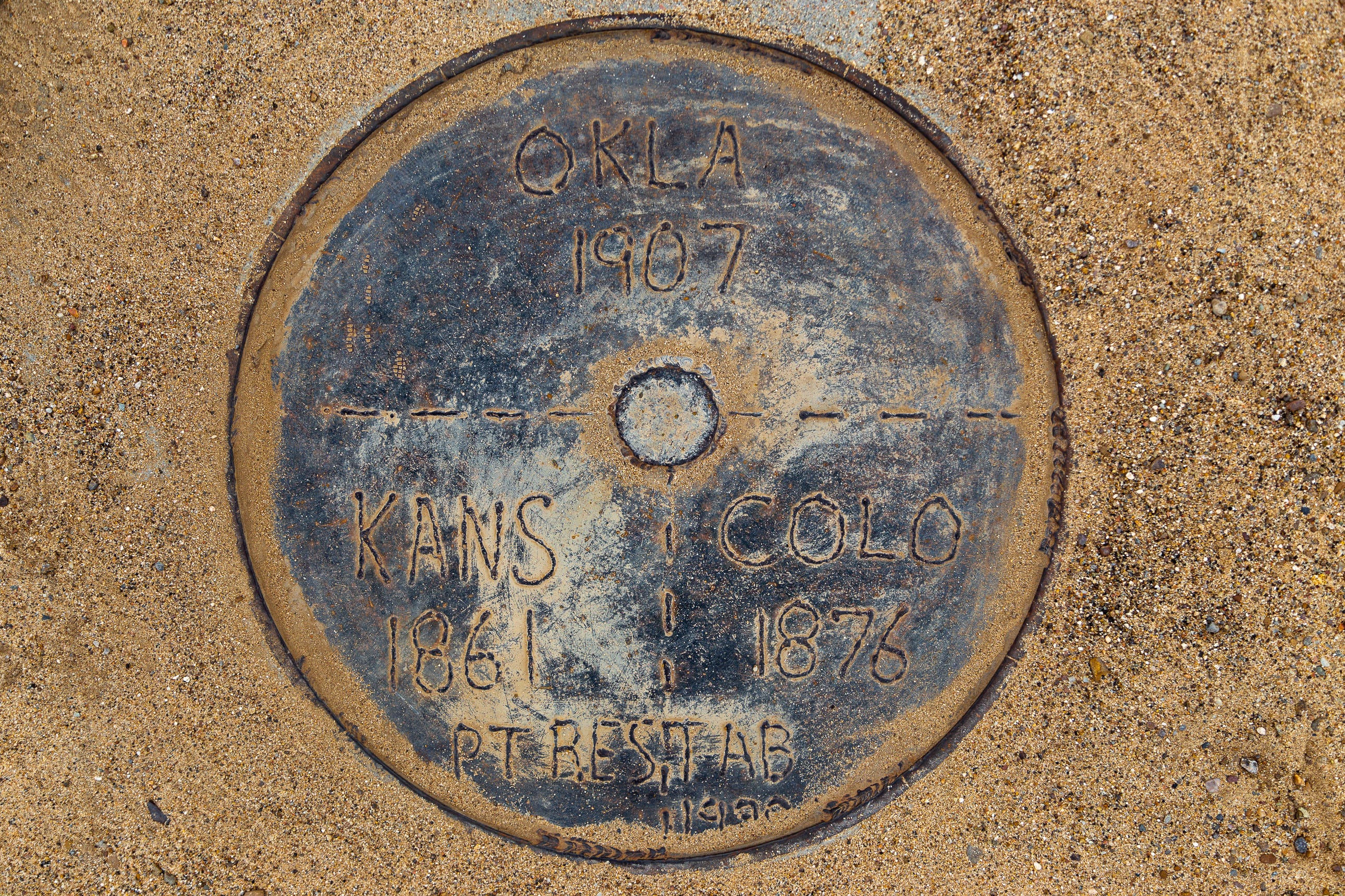
Clever! That windmill-style marker is actually a reproduction. The original version, which was erected in 1903, fell down at some point in the late 2010s; the current version was unveiled on the same site last year. Technically speaking, the location isn’t quite accurate: The monument is wholly within Kansas, and the actual tripoint is a few dozen feet away, marked by a manhole cover in one of the nearby roads, as seen in these next three photos:
Of course, America also has a famous spot where four state borders intersect (technically known as a quadripoint): the Four Corners, marking the convergence of Arizona, New Mexico, Utah, and Colorado. But there’s no raised monument there — just a flat surface, because visitors want to be in four states at once.
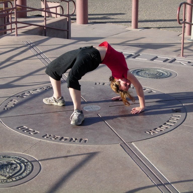
If you look underneath that person, you can see the survey marker on the spot where the four borders meet. Here’s a closer look:
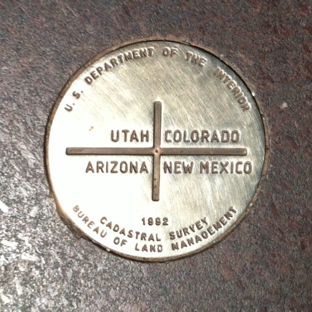
Not as prominent as a stone obelisk, but still quietly effective. Sometimes the simplest designs are the best.
Obviously, there are countless other border monuments out there, so feel free to share your knowledge of them in today’s comments. I’ll be back tomorrow with Day 3 of Boundary Issues, which will be devoted to a really fun border-related topic. See you then!
Paul Lukas has been obsessing over the inconspicuous for most of his life, and has been writing about those obsessions for more than 30 years. You can contact him here.
I'm surprised you didn't talk about what may be our most famous boundary markers: the Washington DC Boundary Stones, which are the original survey markers erected in the early 1790s as part of the land surveys to mark out the new federal capitol's land. They are some of the earliest artifacts that we have that show the words "United States" on them. NPR did a story on them last year: https://www.npr.org/2024/07/04/nx-s1-4940122/boundary-stones-washington-monuments
Delighted to find out there’s a wiki page about tri-points https://en.m.wikipedia.org/wiki/List_of_tripoints_of_U.S._states